Great Flood
Gobekli Tepe (12,000 Years Old)
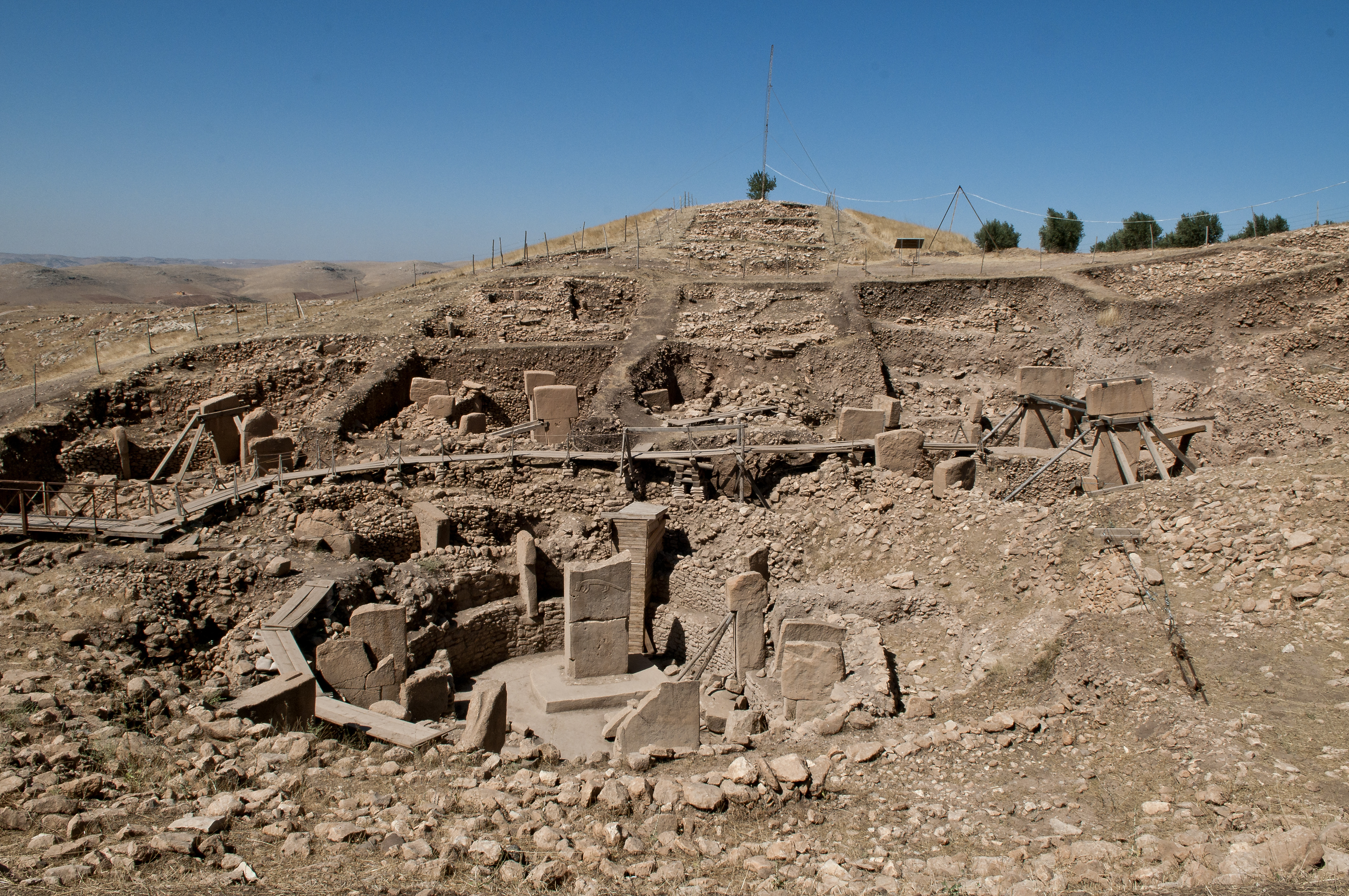
Initially discovered by a Turkish shepherd, and claimed by to have been spotted in a survey conducted by the University of Istanbul and University of Chicago in 1963, the archeological site of Gobekli Tepe is anomalous because it contradicts much of mainstream history about how old human civilization and levels of certain technological knowledge really are. The site has been conservatively dated to 10,000 BC (12,000 years old), which is older than our earliest believed civilizations, like that of Sumer and Egypt, by at least 6,000 years. It was already ancient to ancient Sumer.
The very ancient structures at Gobekli Tepe are astonishing. The sophistication of site and masonry work far exceeds what history and archeological scholars believed possible for 10,000 BC. The site features many circular “rooms” with carved stone pillars that appears to be been used to hold up a roof. On the pillars and other artifacts are carved animal reliefs that would have required immense skill to accomplish. Even though there are theories, the exact purpose of the site is unknown.
The site appears to have been buried for some unknown reason around 8,000 BC, 2,000 years after it’s construction. The site seems well preserved with little sign of destruction, except for the fact it was just buried. There is reasonable speculation that perhaps the site was buried by an ancient flood, perhaps the Biblical Great Flood, which may make sense if the flood brought with it enough lifted ground sediment (dirt and mud) to bury the site naturally without the violent waters of a tsunami.

(image owner: https://en.wikipedia.org/wiki/File:G%C3%B6bekli_Tepe,_Urfa.jpg)
(Image owner: https://commons.wikimedia.org/wiki/File:G%C3%B6bekli_Tepe_site_(1).JPG)
References:
The Mysterious Richat Structure (Atlantis?)
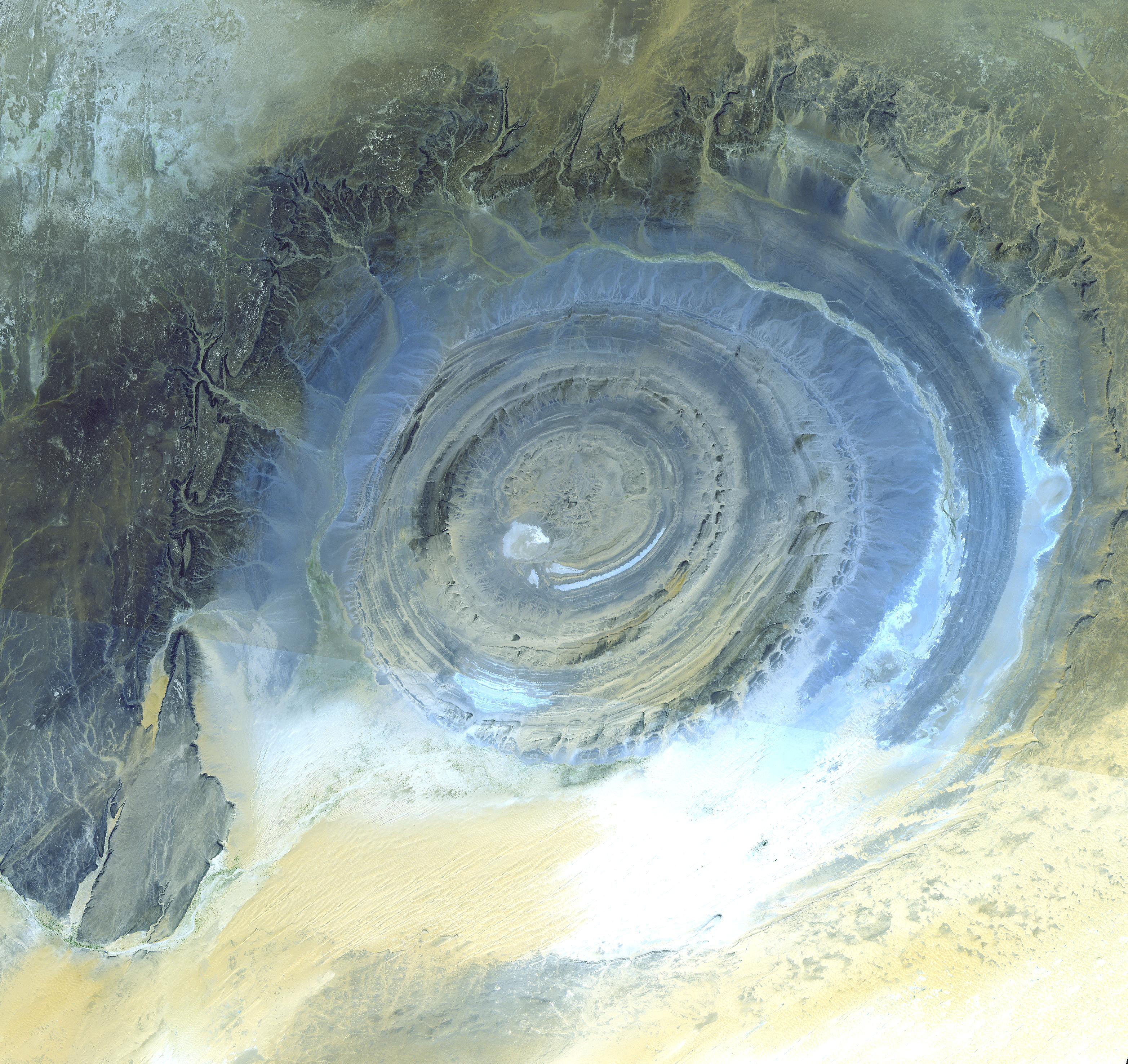
Initially this structure in Mauritania was thought to be an impact structure. It is now believed to be an eroded salt dome, but how it was formed is inconclusive. It is 50 km in diameter (23.5 km largest inner ring), about the size of modern city.
Besides this structure’s mysterious geological origins, it has been proposed by some that this structure closely resembles Plato’s ancient description of Altantis with its large concentric circular rings, and it really does match Plato’s description of Atlantis. It is also located in a region in Mauritania south west of the Pillars of Hercules (Strait of Gibraltar) below the Atlas Mountain range (“Atlantis” mountain range?).
It has been proposed by some researchers that Atlantis existed in the Antediluvian era, in a time before the Great Flood and the prehistoric ancient world’s destruction, and that it was destroyed by the Great Flood in a giant tsunami. It is also possible that parts of the ancient Sahara Desert were ocean. The structure itself does contain salt implying a dried up ancient sea. Perhaps the Mediterranean Sea spilled into the Sahara Desert during or prior to the last ice age, and that water subsequently spilled into the Atlantic ocean. Or it’s possible the land elevations in the past were very different than they are today. There also appears to be on main “channel” or “canal” leading away from the structure, which matches Plato’s description also.
One research has suggested that if this isn’t Atlantis itself, that it is perhaps an ancient city belonging to Poseidon’s ancient empire collectively called Atlantis, which later changed phonologically to “Atlantic”, where Poseidon was a king, not a god.

(Image owner: https://commons.wikimedia.org/wiki/File:ASTER_Richat.jpg)
The following is the only free movie linking the Richat Structure to Atlantis:
References
http://www.gpofr.com/documents/2012Atlantis.pdf (broken link 2014)
Captured: 2012-Atlantis.pdf
https://en.wikipedia.org/wiki/Richat_Structure